Tour des Tajines: A bikepacking route in the Moroccan Atlas
Earlier this week I got back from a week long winter escape from the cold and ice here in the UK to the warmer climes of northern Africa. Megan, Edward and I had a fantastic time and I have had a lot of interest from people wanting top know our route so instead of giving you a blow by blow account of our holiday I thought that I would write it up more as a route guide.

I did quite a lot of research in the build up to the trip and struggled to find a route that suited what we were looking for. I wanted it to be doable in a week including travel, a good mix of surfaces but next to no hike-a-bike (apparently not everyone in our party enjoys this), doable on a gravel bike, and finally see some nice places. So after plenty of research I put something together on Komoot.
This is what I came up with:
This is the route that we ended up riding, with the odd bit of tidying up. Its worth noting that there is lots of new infrastructure being built including some roads which don’t exist on OSM so if you are downloading it via Komoot make sure you select the “stick to original route” option.
This route has been fully recce’d and rides well on both gravel and mtbs. There are however a couple of off road alternatives that are not recced, these were left out on the original scouting mission for a variety of reasons but mostly to save time. They would cut out some of the longer paved climbing sections. I have added these all into a second route but as I haven’t ridden these sections I can’t confirm their rideability.
If anyone is able to get out there and ride these sections then I will update everything accordingly.
Overview of the route.
The route starts in Marrakesh, after taking in the sights, smells and sounds of the souk it exits the town via a reasonably busy road with a bike lane. Before too long it turns into a quiet road for the next 30km or so. The main focus at this point is to “get to the mountains” you will see them rise higher and higher as you approach the foothills. At the 35km mark your tyres touch gravel for the first time as you follow a valley up into the hills. Its undulating but there are a few steep pinches that may require a push for 10m or so. The route continues like this as you gradually gain altitude and follow the valley south. There is plenty of opportunity for resupply but Arba Tighedouine is the first sizeable town and likely the only place to find accommodation in the local area. stock up well because its probably the only place to get food for the next 3-4 hours.
From here the first major climb begins, we took the road pass which is 10km at 8%; a beautiful climb with plenty of camping spots. Alternatively, there is a gravel track that runs vaguely parallel which looks like it would be nice. They both come out into a village at the around 1800m, from here we had to follow our noses a little bit until we cam to the pass. Crossing the pass was a proper “wow” moment, we were met by a wide open valley filled with lush green vegetation clinging onto the orange rock.

The descent is fun and fast, a rough gravel track with a few rocks to avoid but a proper hoot. The surfaces will gradually improve and eventually become paved as you descent into the Ourika valley. Here you will find plenty of opportunities for resupply and accommodation before the big push up to the high point of the route.
The road up to Oukaimeden is long but not terribly steep 37km at 5% sounds tough but its gentle enough that you can tap away at it and settle into a rhythm. It did drag a little and we spotted a gravel track on the other side of the valley that would make the first half a little more enjoyable. (this is found on the alt route). On the way up there is plenty of resupply but camping options are limited until your reach the last 10km or so.
Enjoy a well earned Tajine at 2700m before crossing the other side and finding the gravel track off the other side. The descent is long and twisty and extra care is needed on a gravel bike but still plenty rideable enough. The paths marked on the map bare little resemblance to reality so there was the odd nav error. If you follow gpx track you should be fine though. Half way down there were some serious roads being built which might mean that in future it will be much faster.
As soon as you reach the valley floor you are straight back into climbing mode as you begin another long climb, this time up to 2400m. This climb is steeper than the previous one but the views are even more spectacular as you are greeted with your first sight of the Toubkal range. We mostly followed the road round to the Tamatert pass but we spotted a wonderful gravel track that snaked like spaghetti down from the pass that would cut out a lot of up and down as well as overall distance.
After you reach the pass you have the option to follow either the Road or trail down to Imlil they criss cross each other so there is plenty of opportunity to bail out if desired. It was raining and beginning to get dark so we took the road down into Imlil. Imlil is a bit of a hub for climbing and trekking in the Atlas, here is probably your only opportunity to get any outdoor specific equipment that you may need. Plenty of great accommodation, we stayed at “Riad Atlas Toubkal” at it was fantastic. Imlil was also the first time we saw any other tourists since we left Marrakech.
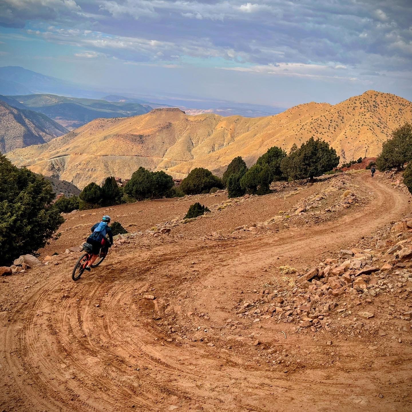
The next pass is one of the highlights of the trip, a gravel track that goes up and over the valley with stunning views of snowcapped peaks and expansive landscapes that show little sign of human impact. There is chance of resupply here so make sure that you pack snacks, Equally the descent is just as fun as it is cut into a very steep valley wall but is plenty wide enough (4-5m) so not to feel too scary.

Once you reach the valley floor and follow the road you get the sense that you are now leaving the Atlas as you fly down the hills with Toubkal behind you. A mix of fast road and gravel takes you to Oued Nfiss resevoir where you can refuel and stock up. From here we tried to take a gravel track up and over the next and final large hill but were greeted by a locked gate. We made the call to take the road round via Asni which meant 40km or so of road. Upon my return I spotted an alternative way over that could work well. This is one bit that it would be great if someone recce’d.
After the town of Ouazguita you start to get the feeling that you are well and truly in the desert now, the tracks are amazing and landscape more rolling. One notable section is the section past Lalla Takahoust reservoir, the trails are designed for quadbikes/buggies/motorcross so are very twisty and turny, great fun on an mtb but Edward was having to nurse his gravel bike around. It also goes through several river beds so maybe best avoided in heavy rain. once you have Reached Lalla Takahoust you are on the final stretch, a mixture of road and gravel takes you back north and into the city. Our route ended up with 20km on a main road, it did have a bike lane and I was comfortable but I have also planned an alternative way into town.
Once you arrive Marrakesh treat yourself to the fanciest tajine you can find and savour the experiance that you have had.
Top tips for the route
Resupply is plentiful so no need to carry a huge amount of food or water with you. Its mostly in the form of local shops or markets, also restaurants and cafes are relatively cheap.
Wild camping spots are plentiful but its sometimes are to find a flat spot especially for a tent.
MTB or Gravel bike would be fine but make sure that you have at least 40mm tyres. I used my steel Mason RAW with a 120mm fork and a dropper post which was fab.
Don’t be intimidated by the long climbs, they are all relatively steady and you can settle into a rhythm.
Hotels are cheap especially and many can be booked in advance in booking.com
Very few people outside of the tourist hotspots speak English but most speak French however the more rural you get the less French is spoken.
It can be very warm in the day but sub-zero at hight so pack up warm.
Take your time to explore, there are a few options to cut out sections later in the route (e.g Imlil to Asni) if you are running low on time. We took 5 days to do the full route.
We were originally fairly concerned about wearing tight fitting clothing but after a day or so Meg was just in normal bibs and jersey an no-one seemed to mind or give her any hassle.
If you are planning on riding the route do let me know and if you need any extra information dont be afraid to reach out.

Dales Divide 22

What is the Dales Divide?
For the past couple of years I have been watching the Dales Divide grow from a small event with only a few entries to one of the most exciting races in the UK. The 605km route starts in Arneside just south of the Lakes and follows a mixture of gravel tracks, singletrack and roads to make its way to Scarborough and back via the Yorkshire Dales and North York Moors. The 2021 edition was a cracker to dotwatch and James Craven took a decent chunk of time off the record.

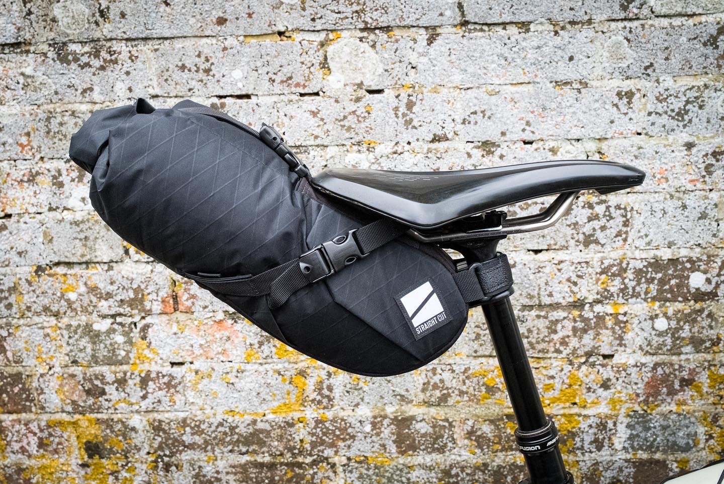
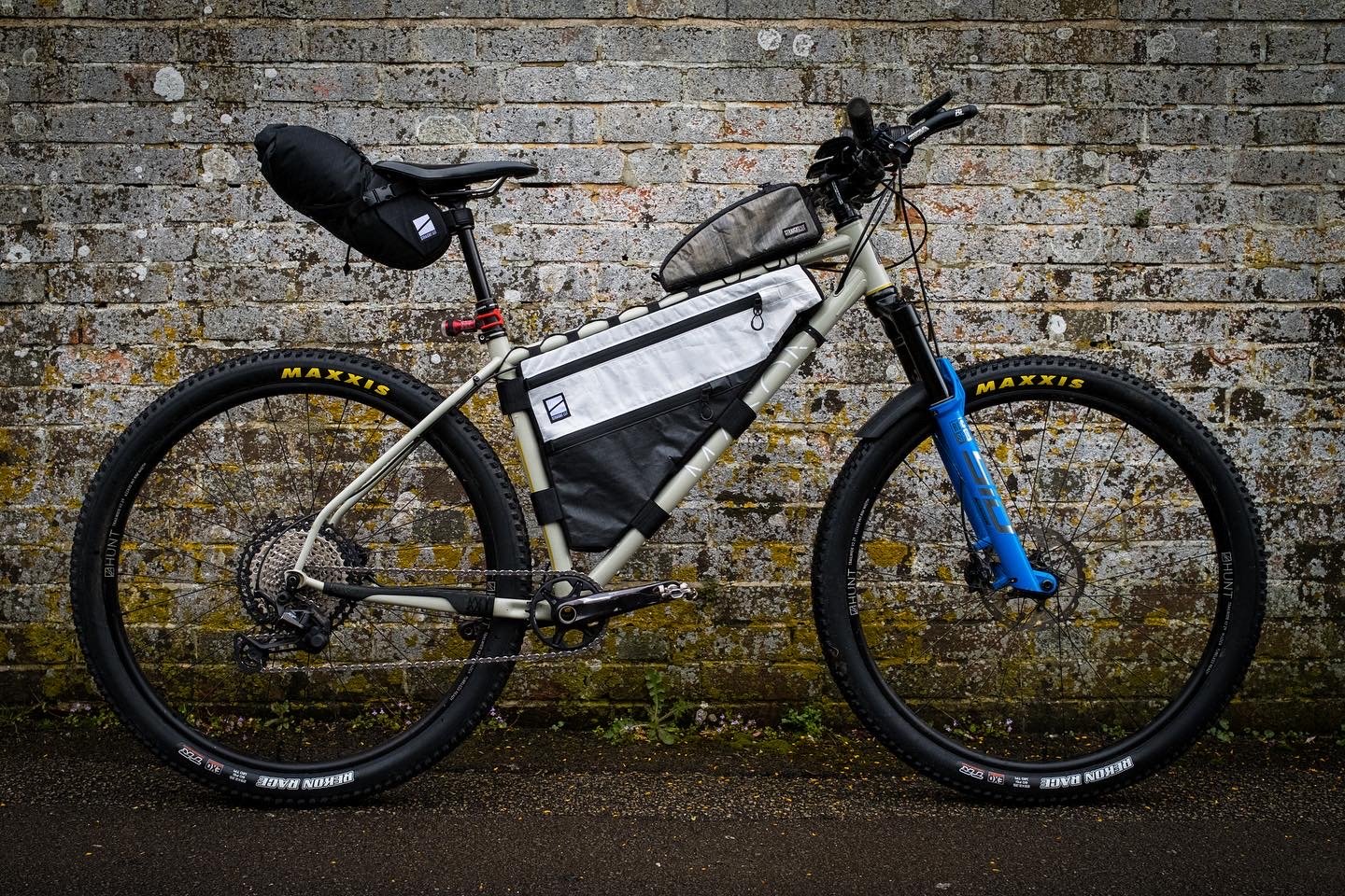
My main goal for the weekend was to test out both my legs as well as some kit before the HT550 in 6 weeks time. I told myself that the result didn't really matter as long as I put together a clean race. Nonetheless, as the day grew closer the inevitable nerves grew and I found myself packing and repacking for the umpteenth time. It was due to be the first time that I was going to race on the Mason RAW and I was finetuning things. I had some new bags from Straightcut which fitted the bike like a dream and I began to pack them with all the usual stuff. See kitgrid below for a full breakdown. Whilst I wasn't planning on sleeping I still packed my OMM sleepsuit and bivvy. I also went fairly conservatively on tools and repairs, batteries and warm kit. The clothing I chose was all from dhb and pretty much the same as I used for GBDURO21 with key items being the Aeron Ultra jersey and shorts which are both super comfortable and have a million pockets to stow snacks. One new thing for me was that I was trialling using a bladder to store all of my water in the frame I had a 3L Camelback which I normally put around 2L of fluid in.
How the race happened
I managed to blag a last minute lift from Steve and Angela, the 5 hour journey passed in a flash of bike chat and I arrived at the pub where I was staying in good time. The inevitable nerves picked up again and I only really got about 3 hours sleep before it was time to make my way over to the start.

The atmosphere was buzzing and after a few choice words from some inspiring people we were off. I remember previous winner Alex Pilkington telling us to leave the racing till Scarborough. With this in my mind I set off at a reasonable tempo, settled into a pack and then slowly let the lead drift away. The first 50km or so were hilly but the terrain was fast and on the first extended climb of the day I caught sight of Chris up the hill and Harry not too far behind him. Before long, I passed Harry nursing his gravel bike through the babies heads and exchanged a few pleasantries. That was the last I saw of anyone for about 15 hours. After descending down to Ribblesdale and under the viaduct we quickly climbed again and I kept pressure on the pedals. I knew this part of the route better than the rest of it and I had a smile on my face as I remembered all of the good times from previous rides.

I kept tapping away until I made it to York 220km into the rote at around 1930. Here, I stopped for a quick meal deal and resupply of fluids. I remember being incredibly frustrated as I waited for what felt like an age for someone to approve the age restricted red bull from the auto checkout. Eventually I have to go find someone. When you are in full race mode these things can get to you when in reality when I look at my gps data I was only stopped for 7 mins.
From York darkness started to hit and the next section of the course was fairly flat and relatively uninteresting so I put some music on and settled into a rhythm and before I knew it I was through Driffield and approaching Scarborough. I look back and see a front light in the distance, I know it must be Harry and sure enough he approaches, his Aerohead and aero socks must have been working on the fast roads. We only ride together for a minute or two before he turns off to find a 24hr petrol station. I press on to Scarborough. Just on the outskirts I notice that my rear tyre is a bit bouncy and in need of some air, I must have been rolling on 10psi for some time as it had mostly been road for the past few hours and I can't think what I would have punctured on.
I had ensured that I had enough food when I left York to last at least 15-16 hours, this meant that I could forgo the kebab shops and petrol stations of Scarborough and pass straight through. This must have been when I passed Chris but I didn’t see him. Feeling strong and relatively awake I left town just before 0200 which meant that I was around 90 mins up on James’s time from last year. Thinking back to what Alex said, now was the time to start racing so I start to turn the screw a little bit and keep my heart rate up as I climbed onto the North York Moors.
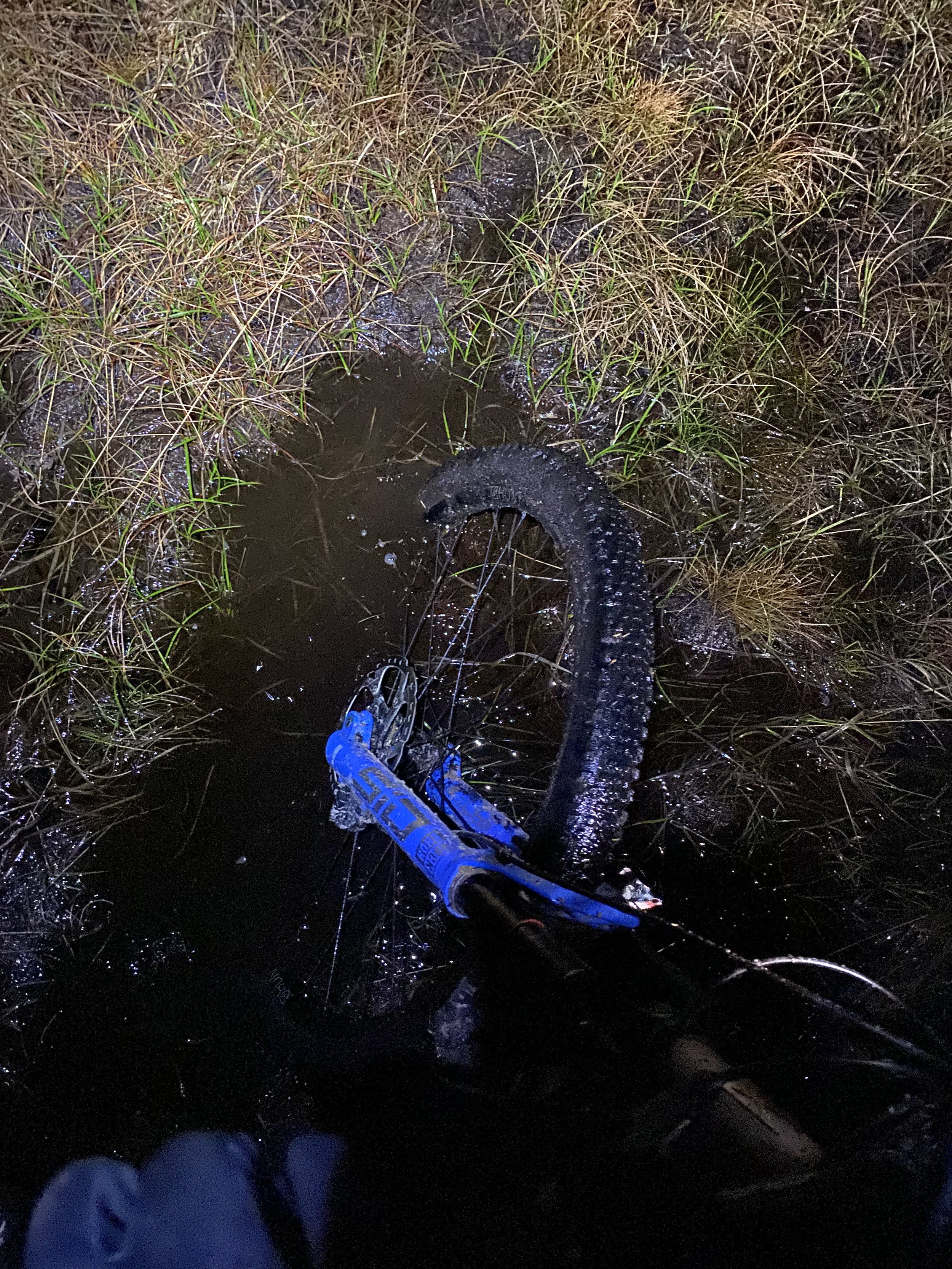
This excitement only lasted a few hours and by 0500 I was feeling low, the mist was in and visibility was around 30m and there was a strong cross headwind that didn’t seem to let up. The paths were mostly very smooth but there was the odd section of bog. I quite like these parts and always seem to find that I make time on them. I checked the tracker for the first time since leaving Scarborough and saw the pursuivants were only 10 mins back or so. This gives me a boost of motivation and I once again wind it up.
Some of the riding across the Moors was the highlight of the route for me; miles of flowing technical single track separated by punchy climbs really let the RAW shine and I found myself more than once grinning ear to ear and pushing it on the descents. I had planned to stop at Northallerton 460km in but after making good time I still had plenty of food and water so I decided that I would push on another 25km or so to Catterick.
The Co-op at Catterick was good to me and I came out with three meal deals, some wine gums and a pack of pork pies. Eating on the move I began the steady climb up into the Dales. The visibility had improved and the sun was out. As a result of which, the landscape here felt much larger, the climbs were less punchy and longer than the rest of the route and I was able to turn up the pace by another notch, conscious that Chris was only half an hour behind or so. Before long I descended into Askrigg and then began the long climb up the Cam High Road, a dead straight roman road that gains 400m of elevation over 10km. Whilst on paper it doesn’t sound too hard however there were some serious ramps and the loose rocks made it challenging at times. From the summit I knew that I had one more serious climb before “it was all downhill”. It was one that I had done three times before as It was on the GBDURO route as well. One last push and I was at the summit. From here I knew that it was my race to lose so I kept it easy and tried to ride conservatively.
Long story short the last 50km were not all downhill there were a few nasty pinches in there but I made good time and rolled onto the pier at Arneside at 1943 to give me a total time of 35 hours and 43 minutes taking just over 4 hours off James’s time. The finish was as ever an anticlimax, with no one there waiting for me I sat on a bench and started to let everything sink in. Just over an hour later Chris arrived. We shared stories for a bit before heading our separate ways in search of food and a bed.
The subsequent day was spent sitting in the sun on the pier whilst eating ice cream and welcoming the riders in as they arrived. I had one more day of recovery before I was then back in the classroom teaching.
A couple of reflections:
The control and comfort of an MTB is well worth the reduced rolling speed on a course like this. The dropper also makes it fun.
In future I would pack a little lighter, I didn’t need any sleeping kit and could have got away with less clothing, battery packs and food but it was good prep for HT550
I had mixed feelings about the bladder in the framepack, It was convenient and had a good capacity but it was hard to regulate how much I had drunk. Never knowing if that sip is going to be your last can be quite mentally taxing. I might try something else for HT550.
Don’t put cans of RedBull in your frame bag as they will explode everywhere.
Minimising stopped time by carrying 12 hours of food is more than manageable.
Not setting off super fast can be an effective strategy to win the race.
Final thoughts:
I just want to thank all of the people who put in the hours for free to make the Dales Divide happen, it truly is a special bike race and I would recommend the route to anyone. Looking forward things are looking positive for HT550 in five weeks time. If you have any questions about the race, route or my setup put them in the comments below.